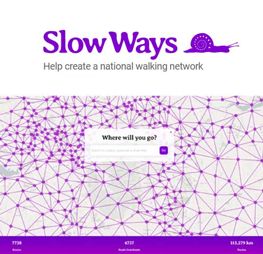
East Point Geo have been working with Dan Raven-Ellison and Slow Ways CIC on a national walking network which links towns and villages all over England, Scotland and Wales. Over 7,000 routes were digitised by hundreds of volunteers during the 2020 lockdown creating a national network that will encourage people to see walking as an important means of travel.
For the past six months Dr Sarah Taigel has been supporting the Slow Ways development team managing their spatial data and carrying out analysis on routes using ArcGIS Online and ArcGIS Desktop. By adding value to the network from integration with landscape scale datasets (such as the CORINE land use database) important statistics for each route have been generated, improving the users’ understanding of the landscape the route moves through. Sarah has also assisted in ArcGIS Online training, developing processes for data management and verification of the datasets the project has developed.
The Slow Ways UK website has now gone live and has been well received!