
GEOSPATIAL MANAGEMENT
We build geographical information systems for data management and spatial analysis.
GEOSPATIAL MANAGEMENT
- Geographical Information Systems (GIS)
- Desktop and cloud-based solutions
- Intuitive database and interface architecture
- Geodetic QC and transformations
- Attribution, metadata and versioning
- Plan-view and alignment charts
- User training
Contact us to discuss how GEOSPATIAL MANAGEMENT SERVICES may benefit your engineering project
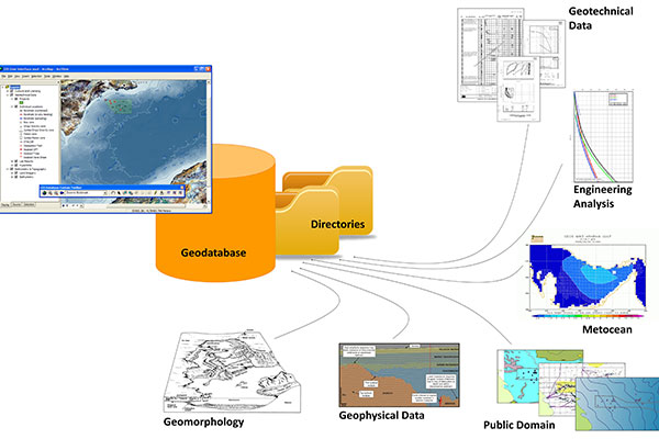
GEOGRAPHICAL INFORMATION SYSTEMS
Geospatial data are ubiquitous in engineering projects and at the core of what East Point Geo do. We build Geographical Information Systems to organise survey, engineering and production data. We use ESRI ArcGIS as standard and can create stand-alone or cloud-based GIS products capable of interfacing with other platforms.
INTUITIVE MAPS
We create simple and effective easy-to-use map outputs, aiding communication of results. We undertake geodetic data QC to ensure accurate plan and alignment charts.
We develop bespoke scripting to assist with data management control.
USER TRAINING
East Point Geo is able to provide face-to-face or web-based GIS training to client teams, produce GIS user guides and provide guidance on best industry practice and how to maximise value from project data.


