
GROUND MODELS
We integrate and interpret geo-data to understand ground conditions for engineering projects.
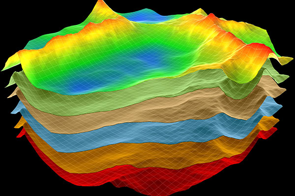
GROUND MODEL SERVICES
- Geophysical interpretation
- Geotechnical integration and analysis
- Terrain and seabed mapping
- Site characterisation
- 3D representation of ground conditions
- Geological history and hazards
- Geological assessment
Contact us to discuss how GROUND MODEL SERVICES may benefit your engineering project
ONSHORE AND OFFSHORE
Good site selection is critical in ensuring practical and economic construction of energy infrastructure. We have worked on major marine infrastructure projects for renewables and oil & gas companies globally. We are the leading UK specialist in peat landslide risk assessments for onshore wind farms. We are also experienced in fluvial, coastal and onshore terrain engineering projects.
SITE SELECTION
We integrate geo-data, perform interpretation and analysis to understand ground conditions that may impact engineering projects. Our interpretations are targeted, efficient and use industry standard software such as IHS Kingdom for geophysical interpretation.
DESK STUDY AND GROUND CONDITIONS
East Point Geo initially build ground models by performing regional geological assessments and desk studies using publicly available data. Ground models are iterated to incorporate factual and interpretive geo-data, which include morphological, geophysical and geotechnical datasets. The ground model forms an effective basis to make engineering decisions and feed future specialist studies.


